RESEARCH

Mapping Geographic Data

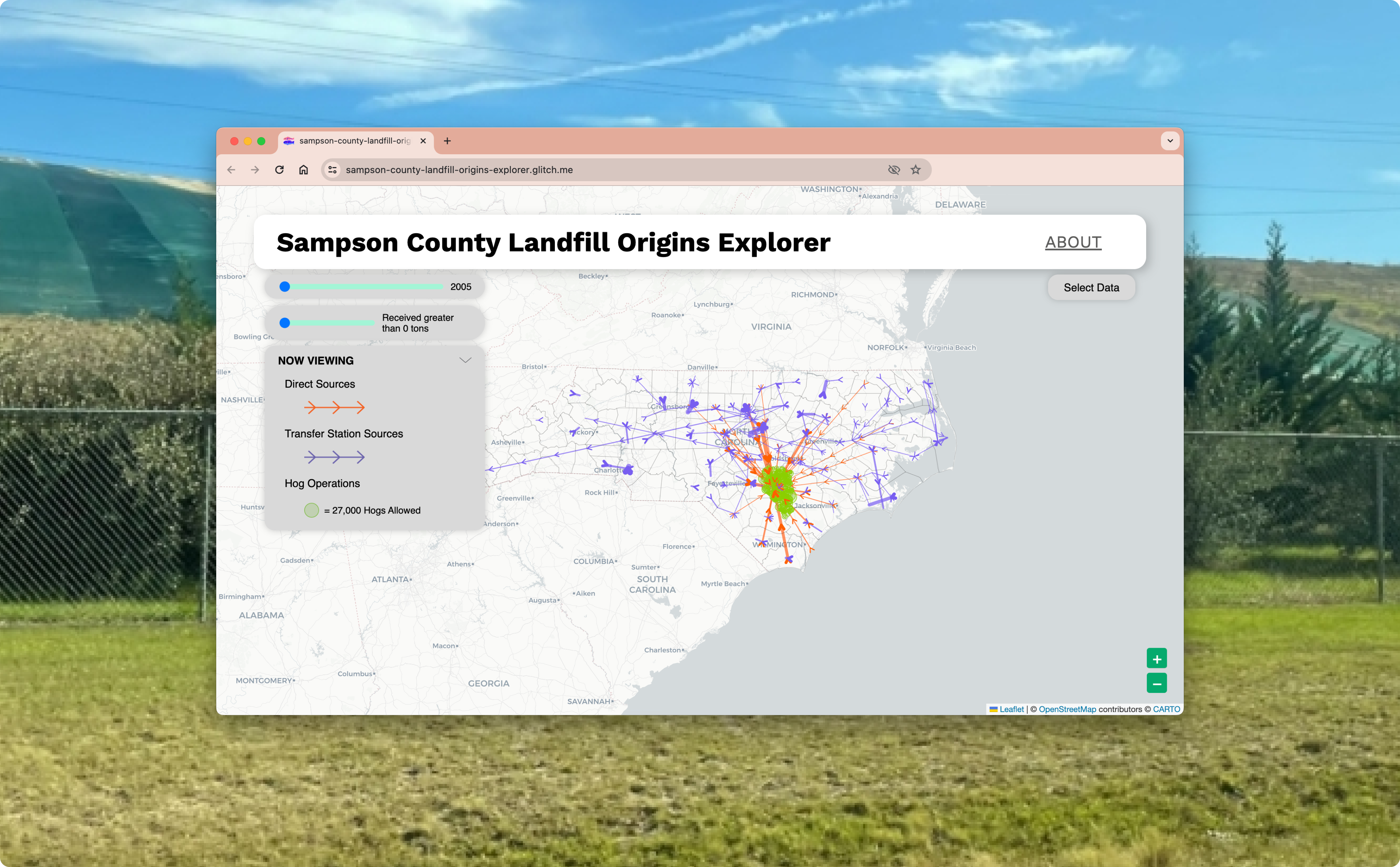
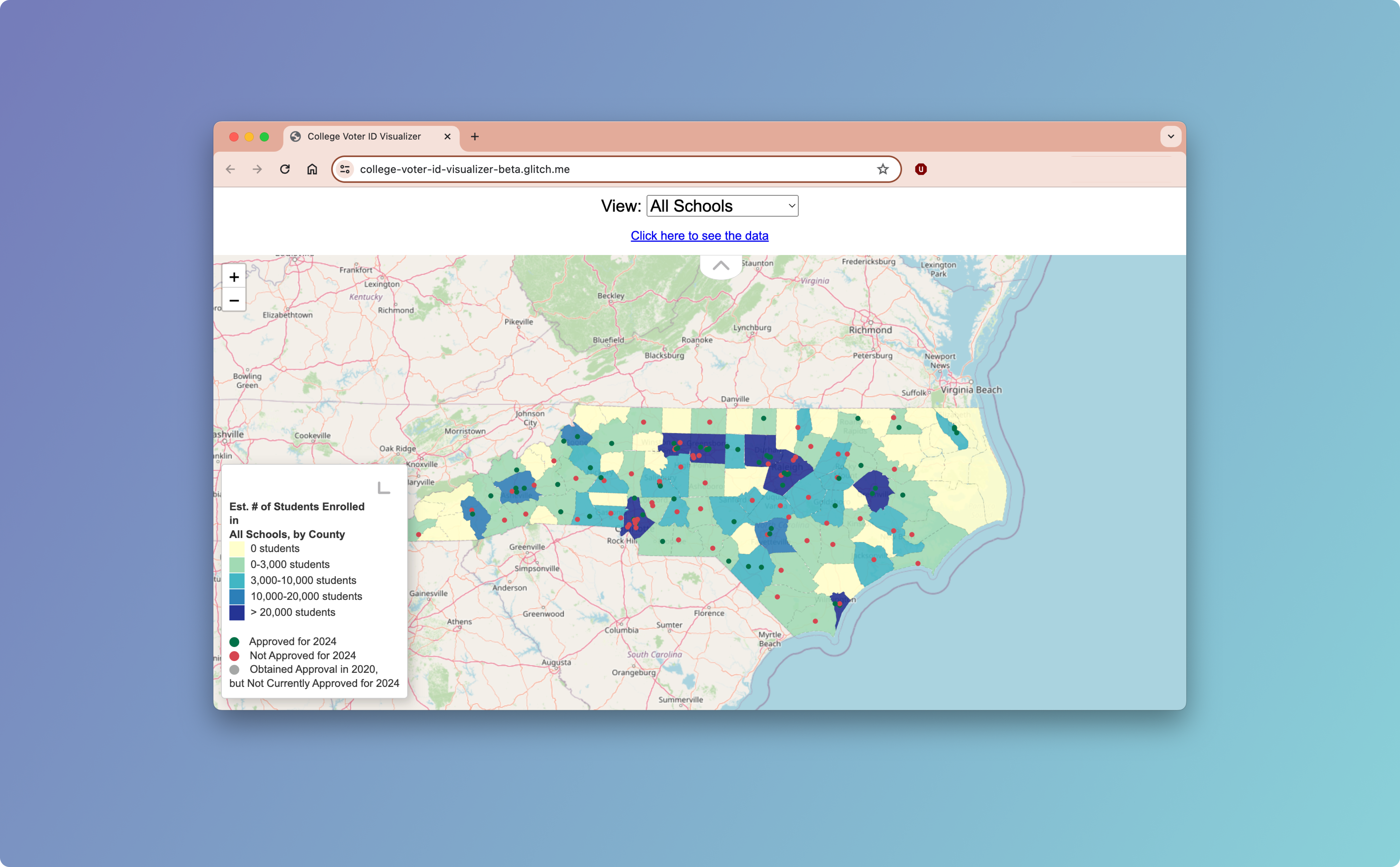
Geographic Information Systems (GIS) data is associated with a specific location or geography, such as geocoded address points, census blocks/tracts, zip codes, counties, states, and other location-based information, and is used to visualize trends within their geographic context. Mapping GIS data is especially valuable for analyzing electoral districts and mapping environmental justice issues.

GIS Data Analysis represented by geographic map

Resources Using GIS Data Analysis

Sampson County Landfill Origin Explorer Digital Interface transposed on top of grassy field

RESEARCH X EJ

Sampson County Landfill Origins Explorer

Using this tool, residents, advocates, and other stakeholders can visualize all of the NC counties that have contributed to the Sampson County regional landfill since 2005.

NC College Voter ID Visualizer user interface

RESEARCH X VR

NC College Voter ID Visualizer

This tool allows users to see which North Carolina schools have voter ID approval for their student IDs.